
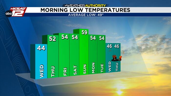
After another chilly morning on Wednesday, sunrise temperatures will warm into the 50s by Thursday and last through early next week. Afternoon temperatures will spike into the 70s Thursday through Sunday, but a weak cool front and increased rain chances will drop temperatures into early next week. Still, no possible freeze yet.
SUNDAY INTO EARLY NEXT WEEK
By Saturday night a front will make a run at our area and may kick up some rain overnight Saturday into Sunday. As of now, the front looks to have a light to moderate impact to temperatures.

An upper-level disturbance is slated to arrive next Tuesday, but keep in mind that’s a long way away in our young and developing science of meteorology. Regardless, we see signs that rain chances can be boosted a bit for Tuesday, but check back for updates because the forecast will be modified.


